Waterfall along the Turkey Path in Leonard Harrison State Park
The Pine Creek Gorge is often called the Pennsylvania Grand Canyon. In my opinion, that name is a disservice. The landscape is nothing like the real Grand Canyon, and it sets the bar impossibly high. The Pine Creek Gorge is a beautiful area, one of the best in Pennsylvania. It is well worth visiting even if you, like me, prefer not to call it by its unofficial name.
This 47-mile gorge in north-central Pennsylvania is mostly surrounded by the Tioga State Forest. Leonard Harrison State Park and Colton Point State Park are located at the northern end of the gorge and are two of the most popular spots along the gorge. Both parks provide nice views of the gorge and Pine Creek.
From a photography perspective, the gorge offers scenic overlooks, beautiful forest, and waterfalls. Some of the views and waterfalls are easy to access, others are much more difficult. This page will feature some of the areas that are easier to access, and in a future post I may cover some of the areas that are more difficult to reach.
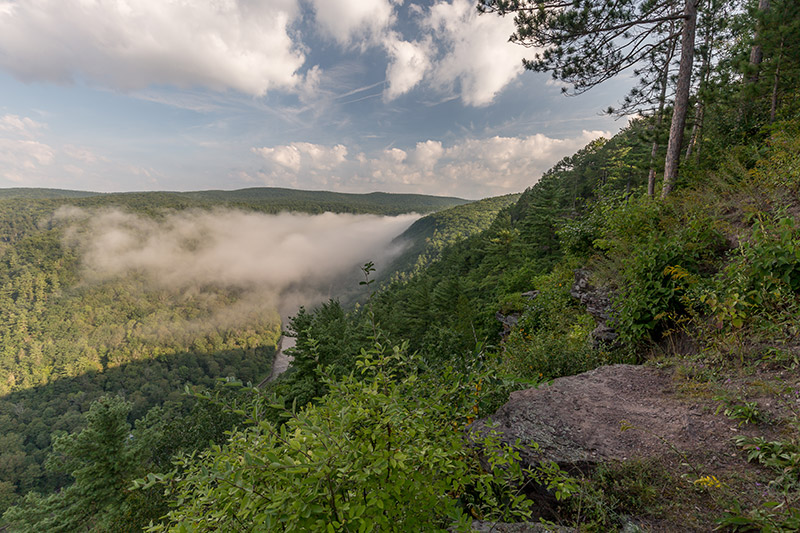
On the morning of my recent visit the gorge was filled with fog, so unfortunately the overlooks had very limited views, or no views at all.
→ See More of the Best Places to Photograph in Pennsylvania
Leonard Harrison State Park
Leonard Harrison State Park is one of the more well-known state parks in Pennsylvania, and is what many people associate with the Pine Creek Gorge. As far as state parks go, it is not a huge park at less than 600 acres. It is located on the east side of the gorge and features several scenic overlooks that provide nice views of the north end of the gorge. You can look across to the west side of the gorge, you can see Pine Creek at the bottom, and depending on what viewpoint you are at, you can look north or south.
Overlook at Leonard Harrison State Park
The GPS coordinates to reach the park are: 41.697113, -77.453859
There is only one entrance to the park, so it is pretty easy to find your way around. From the parking lot you can easily reach a few different view points.
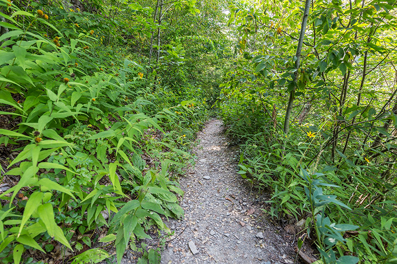
There are only two trails in the park, but both are worth hiking. The Overlook Trail is about a half-mile loop that leads to Otter View, which provides one of the best views in the park. This trail is steep in some places.
The Turkey Path is a 2 mile out-and-back hike that takes you from the rim down to the bottom of the gorge. This is a highlight of the park that you don’t want to miss. It’s pretty steep, but the trail uses many switchbacks to make the steepness manageable. There are also several areas of wooden boardwalks and stairs. The trail is very well maintained and wide in some places.
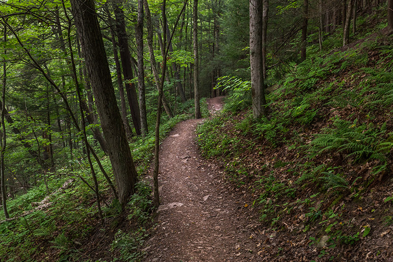
Turkey Path – Leonard Harrison State Park
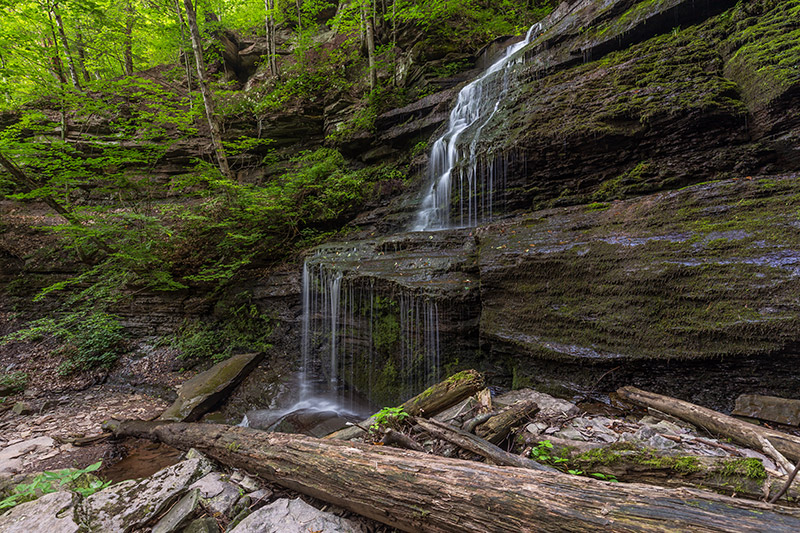
The lower half of the Turkey Path goes along Little Four Mile Run and features a few waterfalls. The volume of water flowing here is not that high, so spring or after a good rain is the best time to view the waterfalls.
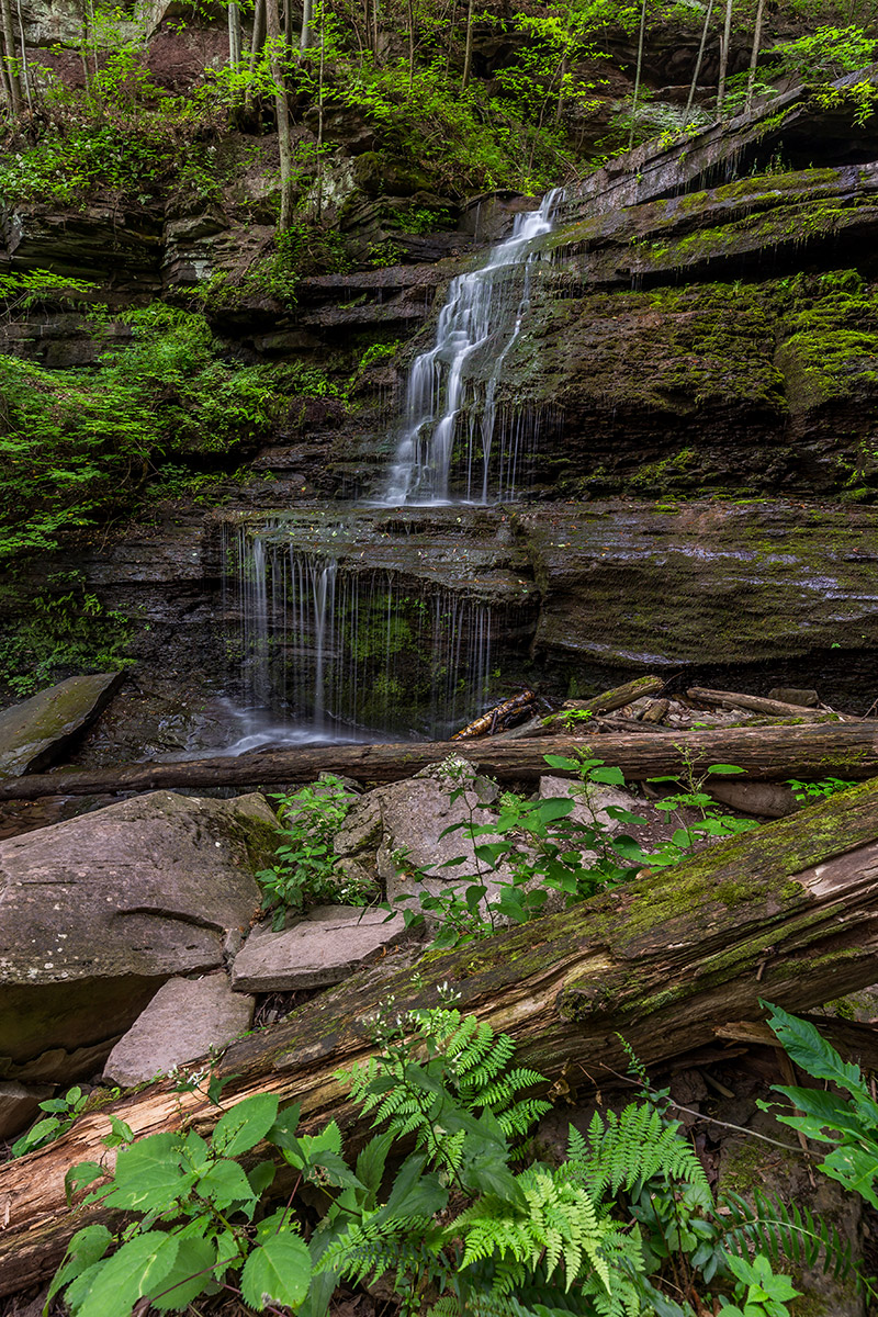
Waterfall along the Turkey Path in Leonard Harrison State Park
At the bottom of the Turkey Path you’ll reach Pine Creek.
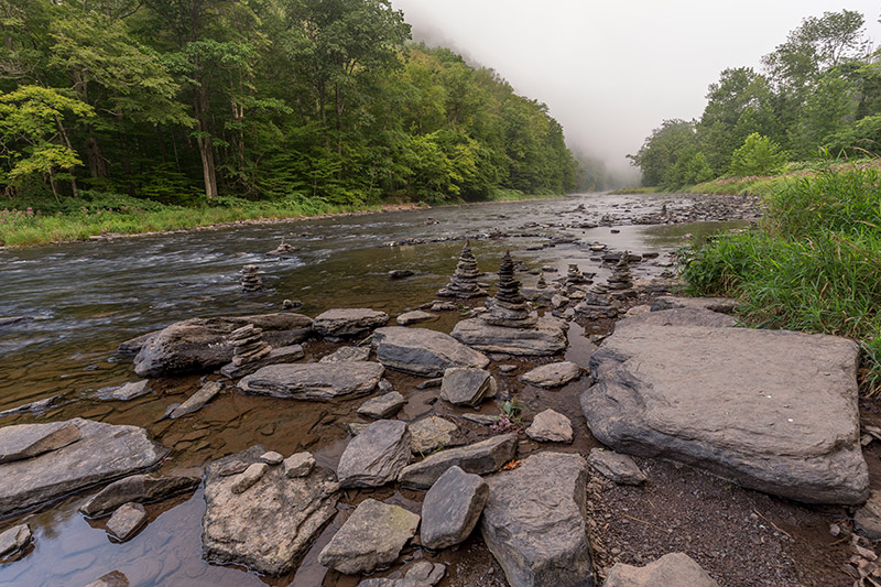
A foggy morning in the Pine Creek Gorge
The Pine Creek Trail, a 62-mile multi-purpose trail that runs along side the creek.
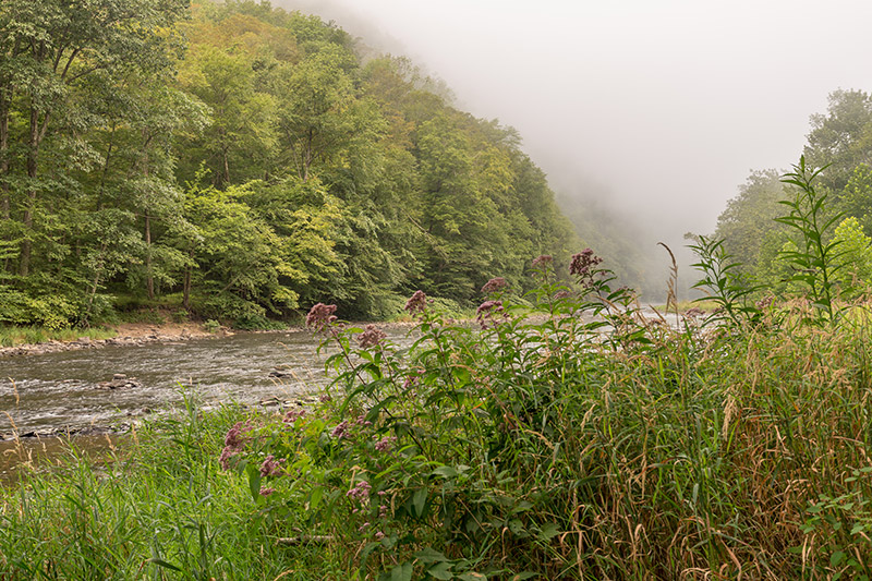
A foggy morning in the Pine Creek Gorge
Colton Point State Park
Colton Point State Park is on the west side of the gorge and provides several overlooks. Leonard Harrison State Park is more developed and has nicer facilities. Colton Point is also a small state park at less than 400 acres.
The GPS coordinates of the parking lot are: 41.700563, -77.465530
If you are traveling from Leonard Harrison State Park to Colton Point State Park you will go north to Ansonia, use Route 6 to cross Pine Creek, and then turn onto Colton Road. After a few miles you will reach the state park.
Along Colton Road before you enter Colton Point State Park you will come to a parking lot for Barbour Rock. The trailhead is at the following GPS coordinates: 41.723239, -77.455797
The trail to Barbour Rock is an easy 1.5 mile hike (roundtrip). From Barbour Rock you will have one of the best views of the gorge.
After you enter Colton Point State Park you will quickly come to the first overlook. There is a small parking lot here, and in my opinion, this is one of the best overlooks in the park.
All of the photos in this article have been processed using the Landscape Legend Lightroom Presets. Learn more about Landscape Legend here.
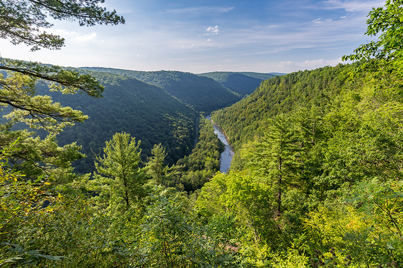
View from the 1st Overlook at Colton Point State Park
After taking in the view at the first overlook, can drive further, or hike on the trail to the other overlooks. The other overlooks are nice, but in my opinion, the first one provides the best view for photographs.
There are two trails in Colton Point State Park. The Rim Trail obviously runs along the rim of the gorge, and it connects the different overlooks.
To make things confusing, Colton Point State Park also has a trail called the Turkey Path. Like the Turkey Path at Leonard Harrison State Park, it is steep and leads you down to the bottom of the gorge. However, there are some significant differences between the two Turkey Paths (by the way, they are totally separate trails and do not connect because of the creek at the bottom of the gorge). The Turkey Path at Leonard Harrison State Park is better maintained. You won’t find any nice boardwalks or wooden stairs on the Turkey Path at Colton Point State Park. The Turkey Path at Leonard Harrison State Park is also generally wider. The Turkey Path at Colton State Park is narrow in some places, with steeper drops off the side of the trail. Still, both trails are highlights of the area and are well worth taking.
Turkey Path – Colton Point State Park
It is possible to photograph some waterfalls from the Turkey Path at Colton Point State Park as well. However, on my recent trip the first waterfall had such a low volume of water I didn’t even bother taking any photos. Lower on the trail I could hear a much more powerful waterfall, and I could see it a little bit through the trees. You have to go off-trail to reach it, and it is quite steep, but possible. I hiked down to this one but when I got there I saw a few big trees were down right in front of the waterfall, so I didn’t get any photos of that one either.
West Rim Trail
The West Rim Trail is a 30-mile trail that runs through the Tioga State Forest along the west side of the Pine Creek Gorge. If you’re up for a long hike that rewards you for with outstanding views, this is a great trail. I can’t say much about this trail because I have never hiked it myself.
Waterfalls
There are a number of waterfalls in the area of the Pine Creek Gorge. However, many of them are very remote and require bushwacking or walking in water to reach. There are no established trails that lead to most of these waterfalls. I may cover some of these waterfalls in future articles, but for now I wanted to focus on the points of interest that are easier to reach.