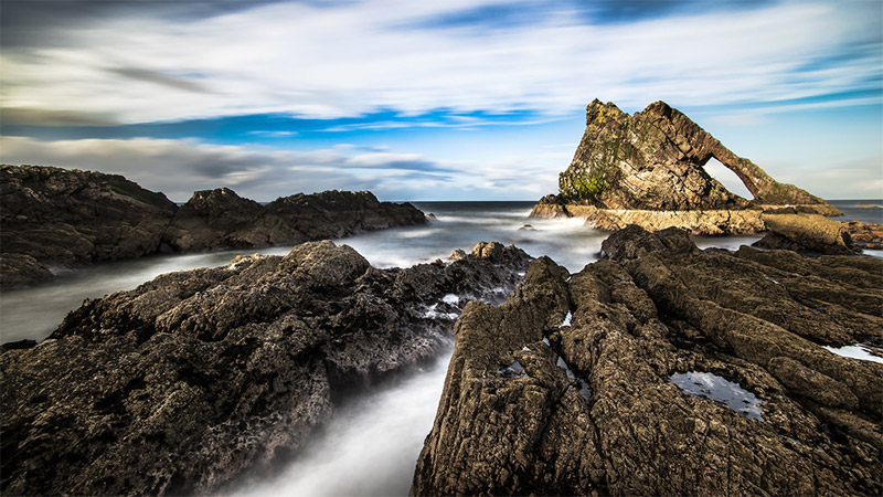
Bow Fiddle Rock by Giuseppe Milo / CC BY 2.0
Scotland, the northernmost country in the United Kingdom, features an amazing landscape that is perfect for photography. The mainland and many surrounding islands offer rugged coastline, mountains, lakes/lochs, waterfalls, and plenty of stunning views. On this page you’ll find information about many of the best places to photograph throughout Scotland. Use the interactive map below to see the locations that are mentioned.
We will be updating this page in the future, so please feel free to leave a comment if you have suggestions of other places that should be mentioned here as well.
Isle of Skye
The Isle of Sky (An t-Eilean Sgiathanach in Gaelic) is one of the islands that forms the Inner Hebrides (the largest of these islands). It is an icon destination with many noteworthy locations for photographing. It is accessible from mainland Scotland by bridge (A87). The island is about 50 miles (80 km) long and features the Cuillins (rocky mountains), cliffs, moors, and lochs.
We could easily dedicate an article just to the Isle of Sky (and hopefully we will in the future), but as a summary, here are some of the main points of interest:
- Old Man of Storr is a large, prominent rock pinnacle that can be seen for miles.
- Quiraing, north of Storr, is a landslip with cliffs and a very dramatic landscape. The Quiraing walk is a loop of about 4 miles (7 km).
- Glen Brittle, on the southern side of the island, features the River Brittle and several tributaries that form waterfalls and the Fairy Pools.
- Elgol is a small village at the southern side of the island that is known for its scenic beauty. It sits along Loch Scavaig with views of the Cuillins. You’ll love the landscape on the drive to Elgol.
- Neist Point, on the west side of Skye, is home to a lighthouse. The view of the cliffs and lighthouse is incredibly beautiful.
- Sligachan is a village near the center of Skye, along A87. It provides a nice view of the Black Cuillin mountains.
- Portree is the largest town on Skye and sits in the northeast part of the island. This is one of the most popular spots with visitors, and provides nice views of the harbor and surrounding landscape.
- Coral Beach is on the northwest part of the island in Claigan. You’ll walk for about 20 minutes through a farm to get to the beach.
- Dunvegan Castle is south of Coral Beach.
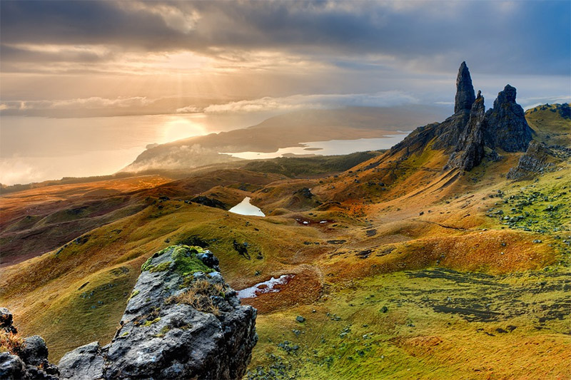
Isle of Skye by Frank Winkler / CC0
Eilean Donan Castle
Eilean Donan is a small tidal island near the Isle of Skye. The castle makes the island a popular spot for photography.
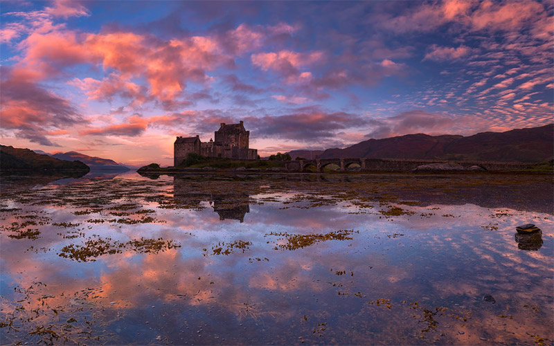
Eilean Donan Castle by John McSporran / CC BY 2.0
Glen Coe
Glen Coe in the Scotish Highlands is a favorite area for many photographers. The glen provides amazing views of the surrounding mountains, including Buachaille Etive Beag and the Three Sisters. The River Coe runs through the glen.
This area is very popular for its natural beauty, and it is also easy to access on A82. There are many options for hiking and climbing in the area.
Glen Coe by Kenneth Barker / CC BY 2.0
The Meeting of Three Waters
The Meeting of Three Waters is a photogenic waterfall at the base of the Three Sisters in Glen Coe. There are three sources of water that meet at the waterfall, before combining and emptying into the Loch Achtriochtan.
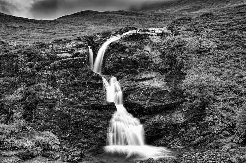
Meeting of the Three Waters by Oliver Clarke / CC BY 2.0
Buachaille Etive Mòr
Buachaille Etive Mòr is a striking mountain at the head of Glen Etive. It can be seen from A82 near Glen Coe, and the River Etive flows around the mountain. This is one of the most popular subjects for photographs in the Scottish Highlands.
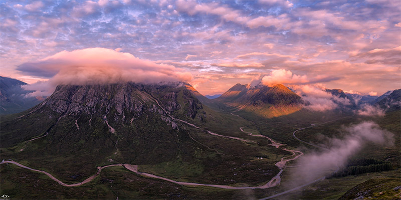
Buachaille Etive Mòr (to the left) by John McSporran / CC BY 2.0
Rannoch Moor
Rannoch Moor is a boggy moorland to the west of Loch Rannoch. This is a wild, rugged landscape that is difficult to explore. Probably the best way to see it is to take the West Highland Railway that crosses the area. If you are up for exploring this remote location there are several hiking trails that you can take.
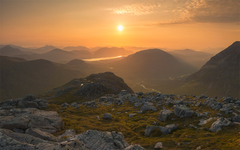
Rannoch Moor by John McSporran / CC BY 2.0
An Teallach
An Teallach is a rugged mountain that overlooks Little Loch Broom. Lord Berkeley’s Seat is an overhanging pinnacle that is quite impressive. You can hike to the summit, or simply enjoy the view and photograph it from the base.
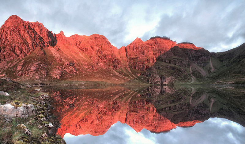
An Teallach by John McSporran
Loch Ness
Loch Ness is a long (23 miles, 37 km), deep lake near Inverness. Of course, it is well known as home of the mythical Loch Ness Monster. The Urquhart Castle sits on the west side of Loch Ness and provides some nice views of the surrounding landscape. The castle is just off of A82.
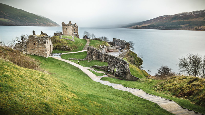
Urquhart Castle and Loch Ness by Giuseppe Milo / CC BY 2.0
Dunnottar Castle
Dunnottar Castle is located on a rocky area of the east coast of Scotland. There is a narrow strip of land that leads out to the castle, with steep cliffs at the edge. The views of the castle, cliffs, and the North Sea are great for photographs.
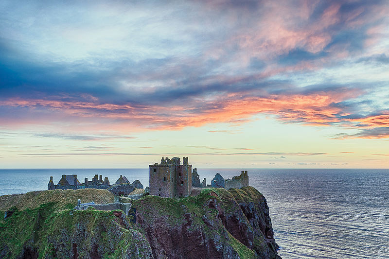
Dunnottar Castle by Tore Sætre via Wikimedia Commons / CC BY-SA 4.0
Cairngorms National Park
Cairngorms National Park, the largest national park in the United Kingdom, includes the Cairngorms mountain range. It covers 1,700 square miles (4,500 square km). The mountains and upland plateau landscape is very beautiful. A9 is the main road within the park, although A95, A86, and A889 all enter the park as well. The many walking trails also allow you to explore the area. The beach of Loch Morlich is a popular spot. Highland Wildlife Park is also located within the national park.
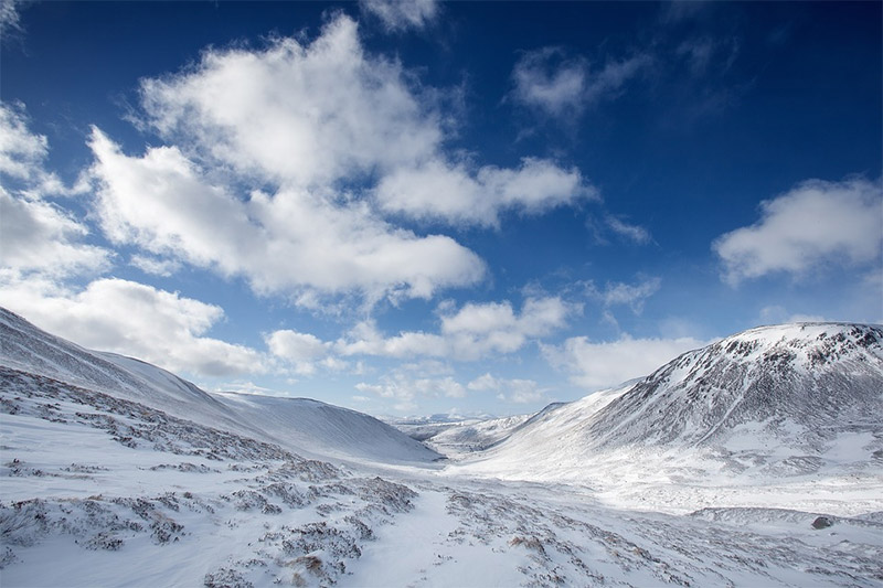
Cairngorms National Park by Free-Photos / CC0
Old Packhorse Bridge
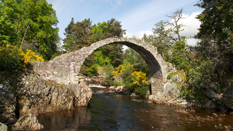
The Old Packhorse Bridge is a well-know, and often-photographed, bridge in the town of Carrbridge, right at the edge of Cairngorms National Park. The bridge was built in 1717 and is the oldest bridge in the Scotish Highlands. The bridge is now unstable and cannot be crossed, but it is still a landmark of the area.

Carrbridge Bridge by Christoph Strässler / CC BY-SA 2.0
The Queen’s View
The Queen’s View in Highland Perthshire provides a spectacular view of Loch Tummel. It is south of Cairngorms National Park and just off B8019. The views are easy to access at the visitor’s center.
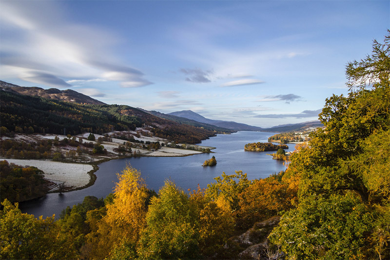
Queen’s View by Ian Dick / CC BY 2.0
Loch Lomond and the Trossachs National Park
Loch Lomond and the Trossachs National Park is located north of Glasgow and southwest of Cairngorms National Park. The park features Loch Lomond, surrounding mountains, and the Trossachs (a woodland glen). The park includes more than 20 Munros (mountains over 3,000 feet or 914 meters). Hiking the Munros is a popular activity, and you’ll certainly get some great views if you are up for the challenge.
A82 runs along the west side of Loch Lomond, providing great access. There are also many waterfalls scattered throughout the park that are worth photographing.
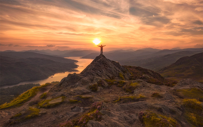
Ben A’an in Loch Lomond and the Trossachs National Park by John McSporran / CC BY 2.0
Kilchurn Castle
The ruins of Kilchurn Castle sit along Loch Awe, northwest of Loch Lomond & the Trossachs National Park. Although the castle is in ruins, surrounded by a lovely landscape it makes a nice photograph. It is not far from A85.
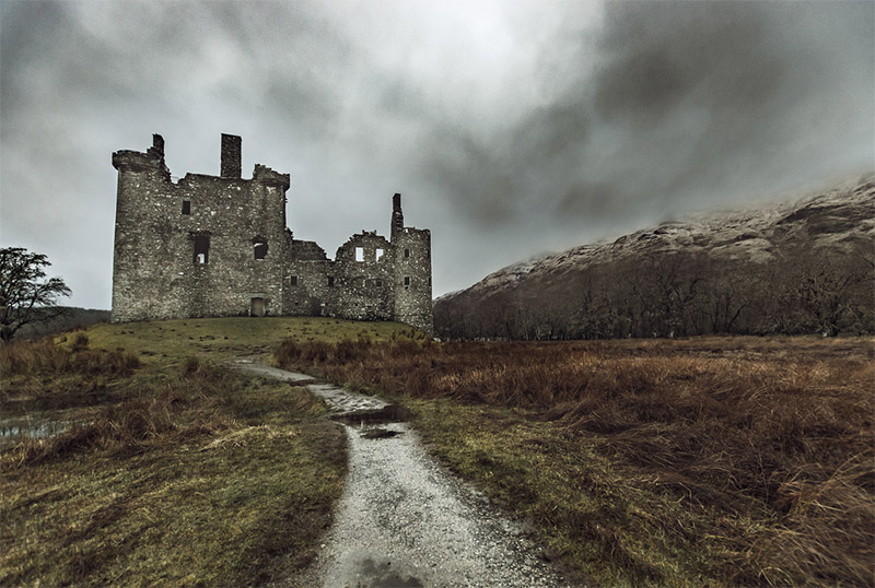
Kilchurn Castle by Neil Williamson / CC BY-SA 2.0
Islay
Islay is the southernmost of the Inner Hebrides islands. It is a large island of more than 230 square miles (over 600 square km). Islay is known for its beautiful landscape and as being a great place for bird watching. Parts of the island feature rugged mountains and cliffs, and there are many lochs. A846 and A847 are the main roads for getting around on the island. The summer months can be busy with tourists. You reach the island by ferry or by air (flights from Glasgow).
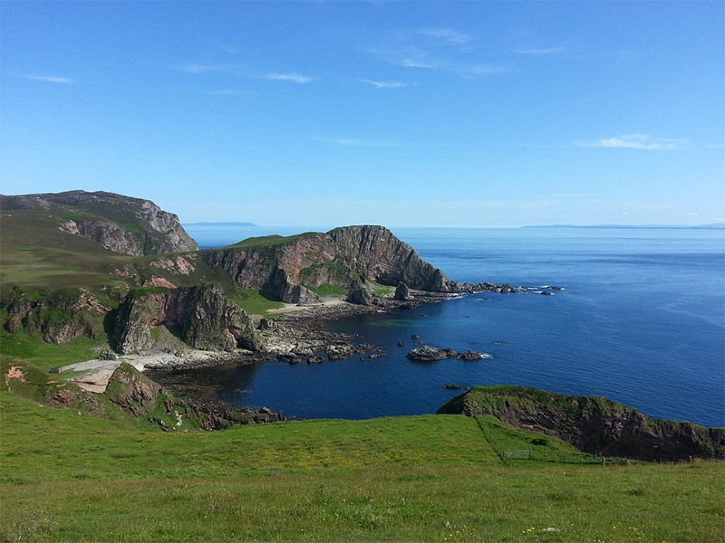
Islay by FixersAndy / CC0
Isle of Mull
The Isle of Mull is another island of the Inner Hebrides. It is north of Islay. Tobermory, at the north end of the island, is the largest village. Summer months can be quite busy on the Isle of Mull because of its popularity with tourists. You can reach the island by a ferry from one of several different locations. The ferry ride is short because the island is close to the mainland.
Home to a scenic landscape and many types of wildlife, the Isle of Mull is a great place for photographers. The natural arches of Carsaig are a popular spot, as is picturesque Calgary Bay.
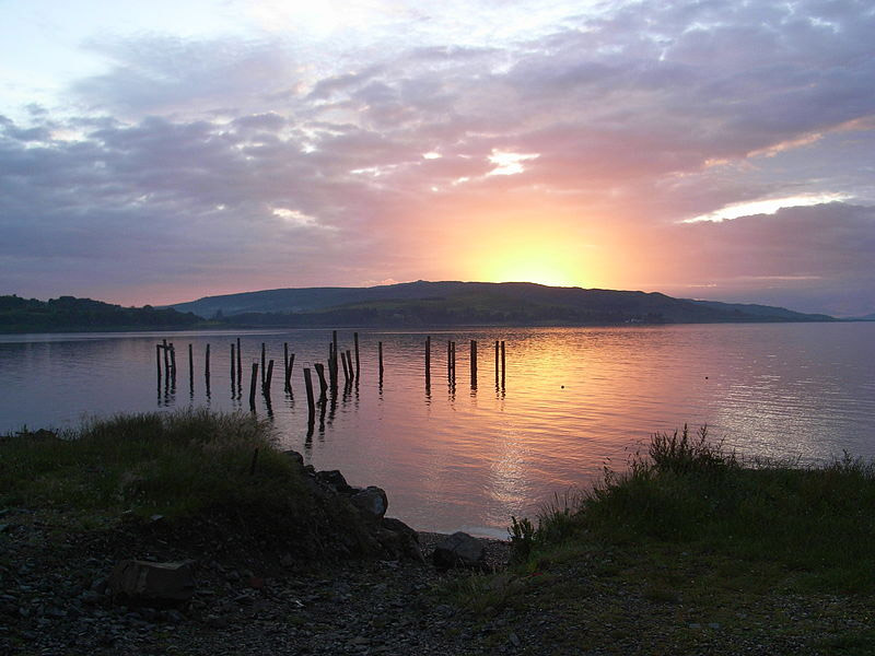
Old pier at Salen on the Isle of Mull by Vangobanshee
Isle of Lewis
The most popular locations in the Outer Hebrides are the Isle of Lewis and the Isle of Harris. Lewis and Harris are actually separate parts of the same island (Lewis on the north and Harris on the south). This island, north of the Isle of Skye, is known of its natural beauty.
Lewis is home to beautiful beaches and coves, and some rocky cliffs. The Callanish Stones are one of the main points of interest. This is a circle of standing stones that dates back about 5,000 years. Lews Castle, near the town of Stornoway, is also a popular location. The Butt of Lewis at the northern end of the island provides a nice place to photograph the rugged coast, as well as a lighthouse.
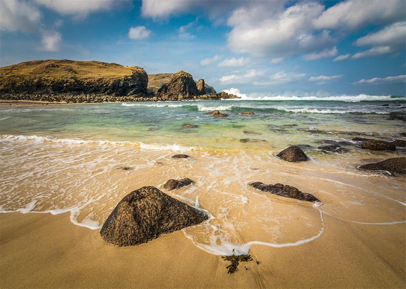
Dalbeg Beach, Isle of Lewis by Chris Combe / CC BY 2.0
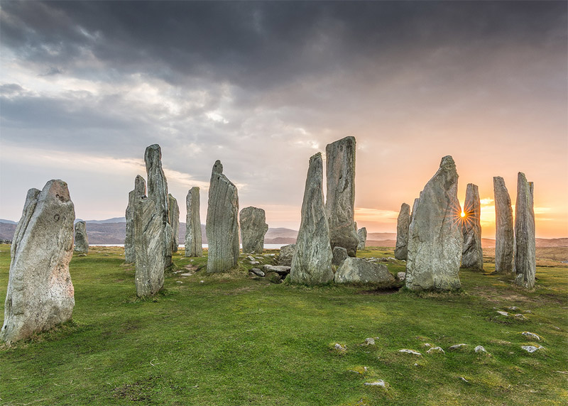
Callanish Stones, Isle of Lewis by Chris Combe / CC BY 2.0
Isle of Harris
The Isle of Harris is the southern end of Lewis and Harris. Compared to Lewis, Harris is more mountainous. Like Lewis, Harris is known for its natural beauty. South Harris features many sandy beaches and is generally less rugged than North Harris.
The Rodel Saltmarsh is a beautiful place to photograph. Seilebost Beach, on the west side of the island, is another excellent location, and a nice view is possible from A859.
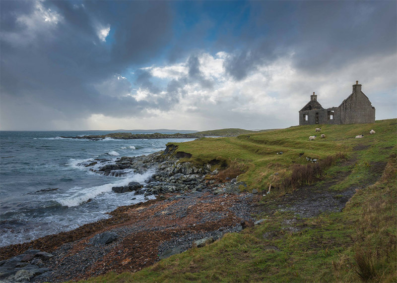
Isle of Harris by Chris Combe / CC BY 2.0
St. Kilda
St. Kilda is a group of Islands in the Outer Hebrides (further away from the mainland than the other Outer Hebrides). Hirta, the largest island, features the highest sea cliffs in the UK. All of the islands of St. Kilda are now owned by the National Trust for Scotland, and there are no current year-round residents, aside from military.
Getting to St. Kilda is not easy, but it is possible. You can take a charter boat, and there are a few cruises that also go to St. Kilda. Those who make it will love the remote, rugged landscape. There is also a lot of wildlife, mainly seabirds.
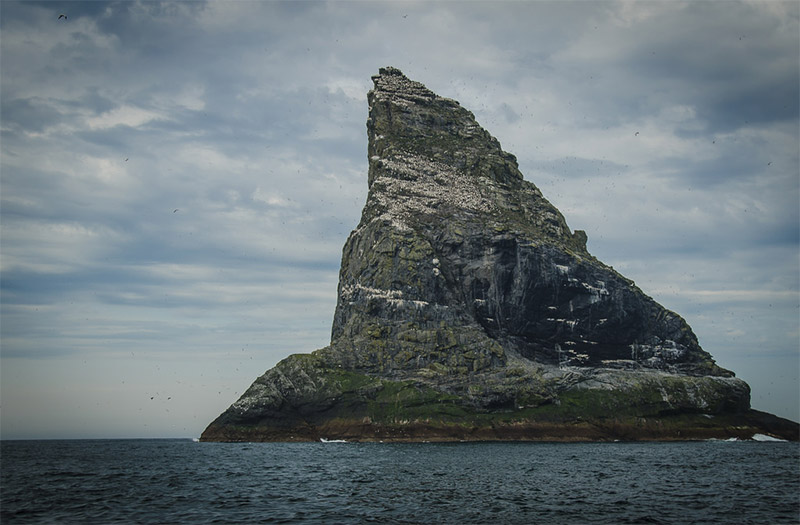
St. Kilda by Donna Green
Ben Nevis
Ben Nevis is the highest mountain in Scotland, and all of the United Kingdom. It is near the town of Fort William, north of Kilchurn Castle. Many people hike or climb to the summit, with the Pony Track from nearby Glen Nevis being the most popular path.
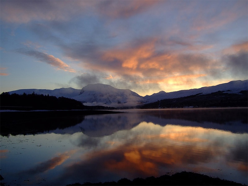
Ben Nevis by SupportTNI / CC0
Steall Falls
Steall Falls is in Glen Nevis and is Scotland’s 2nd-tallest waterfall at just under 400 feet (120 meters). A path runs through the gorge and provides a nice view of the falls.
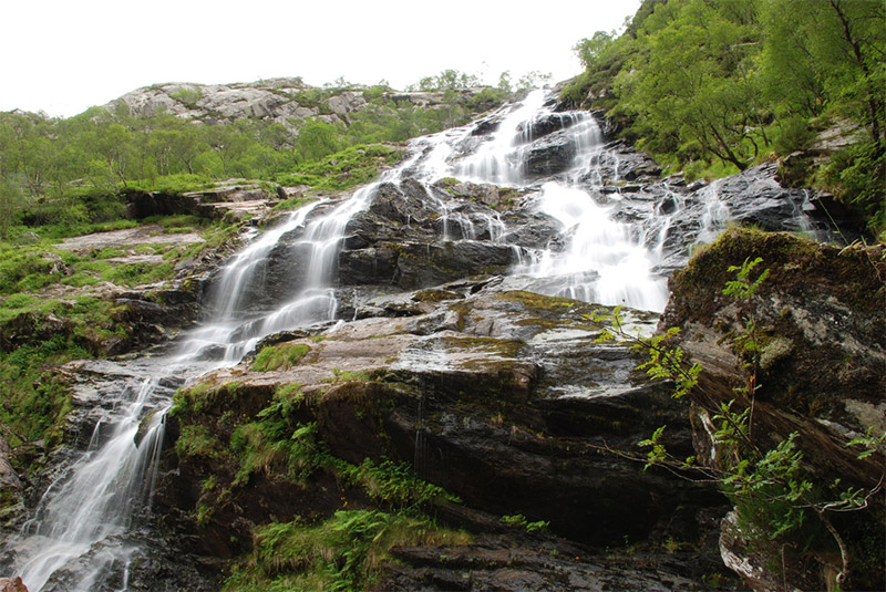
Steall Falls by keithloaf1961 / CC BY-ND 2.0
Loch Shiel
Loch Shiel is 17 miles (27 km) long and west of Fort William. The northern part of the loch is beautifully surrounded by mountains and ideal for photography. The town of Glenfinnan is easy to access (along A830 at the north of the loch) and provides and excellent view, as shown in the photo below.
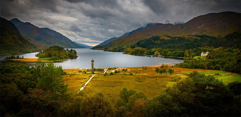
Loch Shiel by Walkerssk / CC0
Shetland Islands
The Shetland Islands (or just Shetland) are a group of islands about 110 miles (170 km) off the coast of mainland Scotland. The main island is called Mainland, although there are several other inhabited islands, and many more that are uninhabited. Flights are available from a few cities, including Glasgow and Edinburgh. Or you can take a very long ferry rides. Ferries are the main transportation between the islands. The culture here is a bit of a blend between Scotland and Scandinavia.
The landscape features amazing, rugged coastline, beautiful beaches, lochs, and moors.
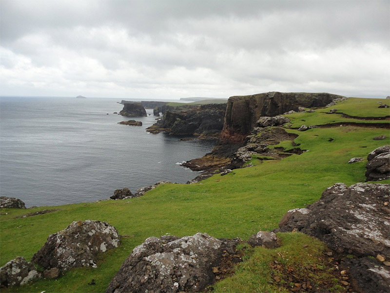
Shetland Islands by dpbueroservice / CC0
Orkney Islands
The Orkney Islands (or just Orkney) are also off the north coast of Scotland, but much closer to the mainland as compared to the Shetland Islands. There are about 70 islands, with about 20 of them being inhabited. Like the Shetland Islands, the main island here is also known as Mainland. The landscape here is mostly low-lying, but there are some hills and cliffs. You can reach the islands by ferry or plane. The beaches and wildlife (especially migrating birds) are favorites for photographers.
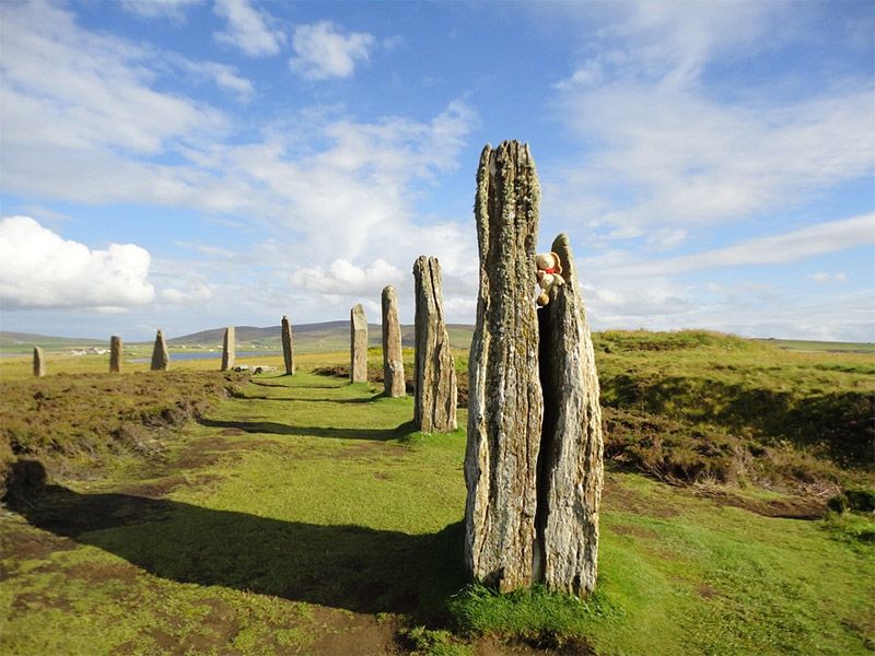
Orkney Islands by dpbueroservice / CC0
The Scottish Borders
The Scottish Borders is a region south of Edinburgh. This rural area is home to a beautiful landscape of hills, lochs, and the River Tweed, as well as castles and abbeys. Some of the main points of interest include:
- The Berwickshire Coastal Path
- Mire Loch
- St. Mary’s Loch
- Coldingham Bay
- Abbotsford House
- Mellerstain House
- Floors Castle
- Duns Castle
- Thirlestane Castle
- Melrose Abbey
- Dryburgh Abbey
- Jedburgh Abbey
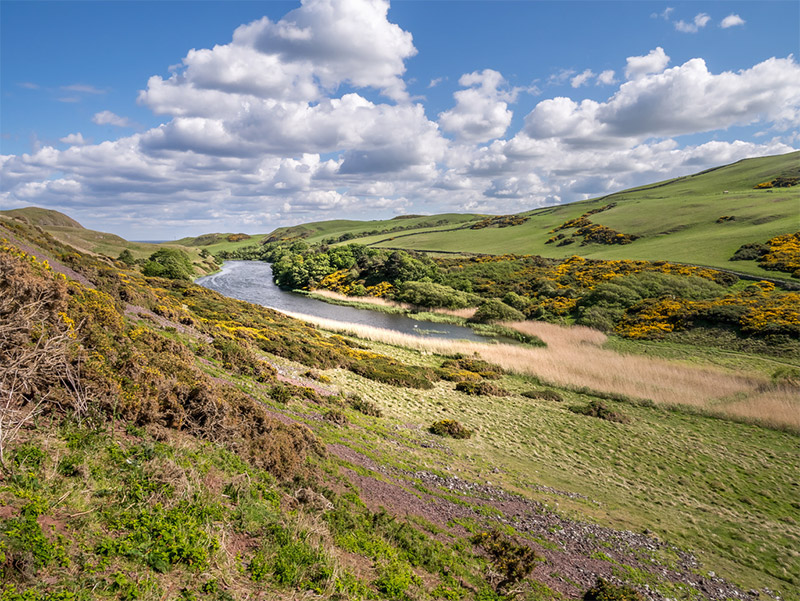
Mire Loch, The Scottish Borders by Matthew Hartley / CC BY-SA 2.0
Ullapool
Ullapool, in the Scottish Highlands, is a small port village and a tourist destination. Its picturesque setting on Loch Broom and the surrounding mountains make it a great place for photography. Ullapool is located at the north end of A835.
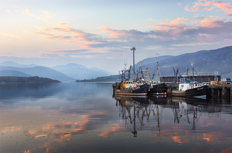
Ullapool Harbour by Neil Williamson
Arthur’s Seat
Aruthur’s Seat is the highest peak among several hills in Edinburgh’s Holyrood Park. It is a popular spot for hikers and provides a great view of Edinburgh and the surrounding area.
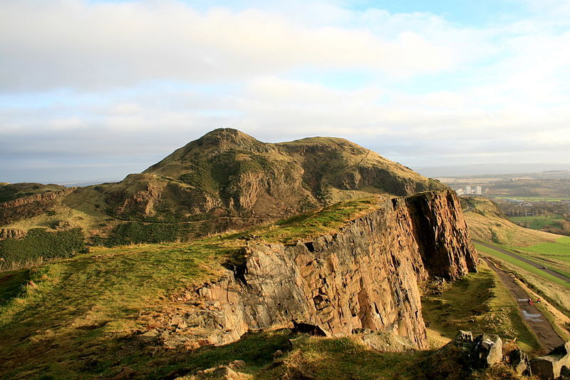
Arthur’s Seat by Przemysław Graczyk / CC BY-SA 3.0
Calton Hill
Calton Hill is also in Edinburgh, a very short distance from Holyrood Park. It provides a nice view and is a popular spot for photography.
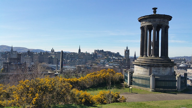
Calton Hill by waldomiguez / CC0
Bow Fiddle Rock
Bow Fiddle Rock is a well-known rock formation near Portknockie on the northeast coast of Scotland.

Bow Fiddle Rock by Giuseppe Milo / CC BY 2.0
Finnich Glen
Finnich Glen is a beautiful and very deep gorge near A809 in Craighat, north of Glasgow. This area is sometimes called the Devil’s Pulpit, but the Devil’s Pulpit is actually a specific rock in the glen. There are some old stone steps known as Jacob’s Ladder that lead you safely down to the bottom.
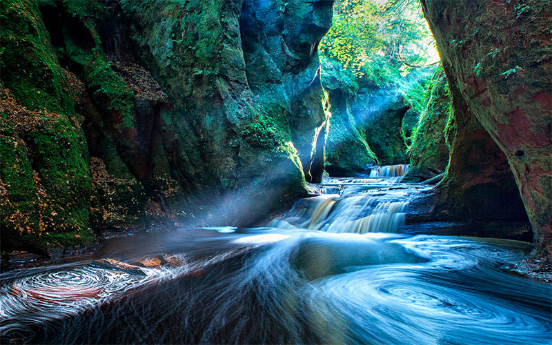
Finnich Glen
Photo license links: CC BY-ND 2.0, CC0, CC BY-SA 4.0, CC BY-SA 3.0, CC BY-SA 2.0, CC BY 2.0